Map of Lucknow City

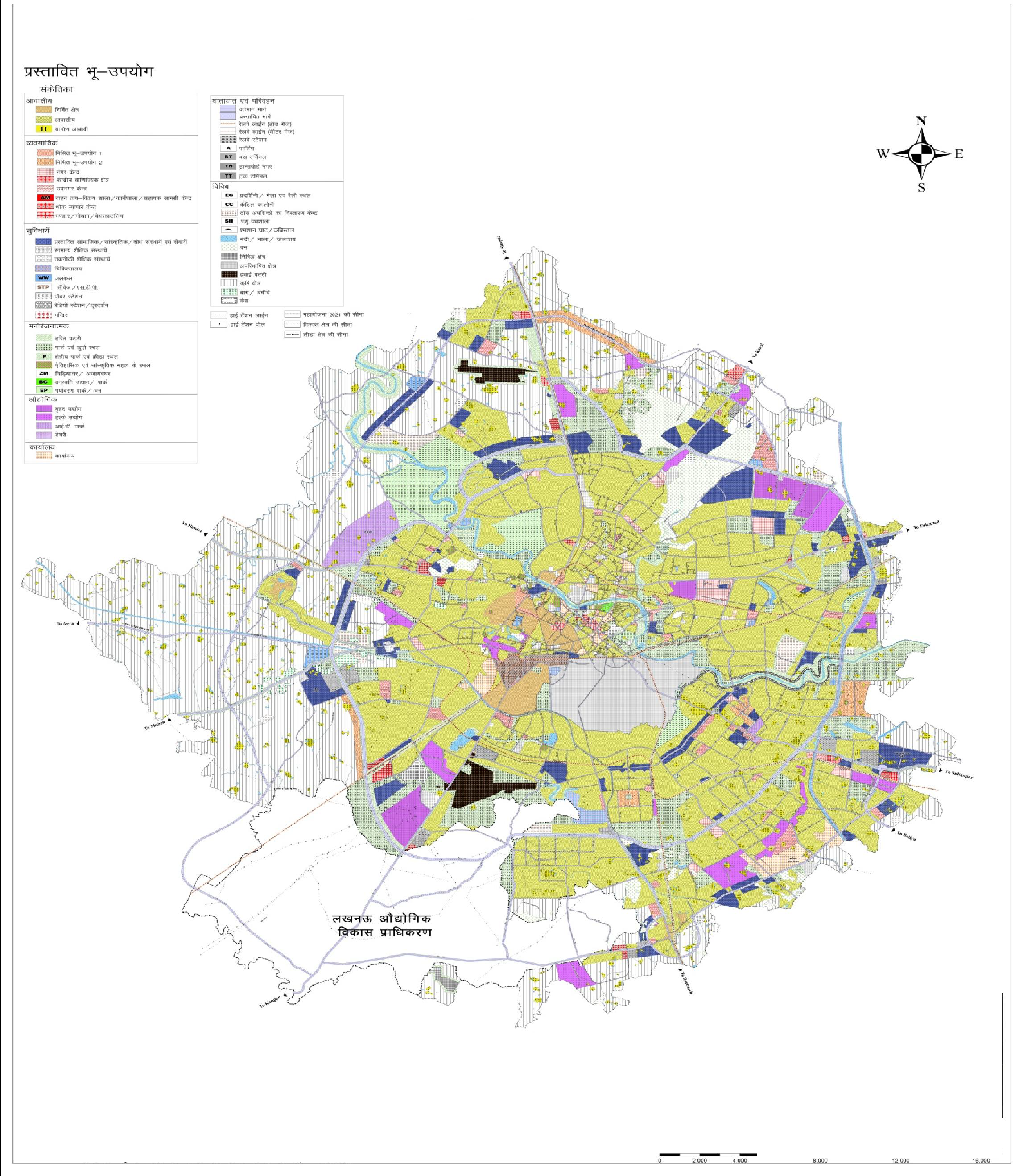
As per the Map of Lucknow (master plan 2031), Lucknow has a total of 31 zones. The total area under Lucknow municipal corporation is 402 sq km, which may extend up to 631 sq m in future. As of now, there is a total of 110 wards under Lucknow Municipal Corporation.

Map of  Lucknow is categorized & marked as following

  • Residential – Light Orange & Green
  • Village Residential – Dark Yellow
  • Institutional & Educational – Blue & Blue dots & Lines
  • Industry – Purple & Purple shades
  • IT Park- Purple with Strips
  • Commercial – Pink & Red Shades
  • Agriculture – Green Strips
  • Wholesale/ Warehousing – Red with Checks
  • Transportation – Grey with Checks
  • Greens (Recreational, Park & playgrounds)
Source: Lucknow Master Plan 2031

Source: Lucknow Master Plan

Lucknow - Google Map

Source: Lucknow Master Plan

Map of Lucknow | Lucknow City – Divisions
Tagged on:     

Rajeev Rana

Rajeev Rana is an independent writer and researcher with a strong interest in history, population studies, and demographic trends in India and North America. He has been writing on demography-related topics for over five years, focusing on census data, migration patterns, ethnicity, and regional population changes. While not a formally certified demographer, Rajeev closely follows official data releases from government sources, census authorities, and reputable research institutions. His work aims to present complex demographic information in a clear, accessible, and neutral manner for readers seeking factual insights and broader context. Rajeev contributes to multiple informational websites and has particular familiarity with demographic and regional trends in the Delhi NCR region. His writing is driven by curiosity, data interpretation, and a commitment to accuracy rather than advocacy or opinion