do you want to know How many districts in Odisha / Total district in Odisha ?
Odisha is a state in Eastern India. As of 2024, there are a total of 30 districts in Odisha. There are three divisions and each division consists of 10 districts. The divisions are Central, North, and South with their headquarters at Cuttack (Central Division), Sambalpur (Northern Division), and Berhampur (Southern Division) respectively.
Mayurbhanj is the largest district by area and Jagatsinghpur District is the smallest district in Odisha. Ganjam District is the most populated district and Debagarh (Deogarh) District is the least populated district in Odisha.
read about Population in Odisha
List of Districts in Odisha
| # | District | Population (2011) | Area (km²) | Density |
| 1 | Angul | 12,73,821 | 6,232 | 200 |
| 2 | Balangir | 16,48,997 | 6,575 | 251 |
| 3 | Balasore | 23,20,529 | 3,634 | 610 |
| 4 | Bargarh (Baragarh) | 14,81,255 | 5,837 | 254 |
| 5 | Bouda | 4,41,162 | 3,098 | 142 |
| 6 | Bhadrak | 15,06,337 | 2,505 | 601 |
| 7 | Cuttack | 26,24,470 | 3,932 | 667 |
| 8 | Debagarh (Deogarh) | 3,12,520 | 2,781 | 106 |
| 9 | Dhenkanal | 11,92,811 | 4,452 | 268 |
| 10 | Gajapati | 5,77,817 | 3,850 | 134 |
| 11 | Ganjam | 35,29,031 | 8,070.60 | 430 |
| 12 | Jagatsinghpur | 11,36,971 | 1,759 | 682 |
| 13 | Jajpur | 18,27,192 | 2,888 | 630 |
| 14 | Jharsuguda | 5,79,505 | 2,081 | 274 |
| 15 | Kalahandi | 15,76,869 | 7,920 | 199 |
| 16 | Kandhamal | 7,33,110 | 8,021 | 91 |
| 17 | Kendrapara | 14,40,361 | 2,644 | 545 |
| 18 | Kendujhar (Keonjhar) | 18,01,733 | 8,240 | 217 |
| 19 | Khordha | 22,51,673 | 2,887.50 | 800 |
| 20 | Koraput | 13,79,647 | 8,807 | 157 |
| 21 | Malkangiri | 6,13,192 | 5,791 | 106 |
| 22 | Mayurbhanj | 25,19,738 | 10,418 | 242 |
| 23 | Nabarangpur | 12,20,946 | 5,294 | 231 |
| 24 | Nayagarh | 9,62,789 | 3,890 | 248 |
| 25 | Nuapada | 6,10,382 | 3,408 | 158 |
| 26 | Puri | 16,98,730 | 3,051 | 488 |
| 27 | Rayagada | 9,67,911 | 7,584.70 | 137 |
| 28 | Sambalpur | 10,41,099 | 6,702 | 157 |
| 29 | Subarnapur (Sonepur) | 6,10,183 | 2,284 | 261 |
| 30 | Sundargarh | 20,93,437 | 9,712 | 216 |
read about religion in Odisha
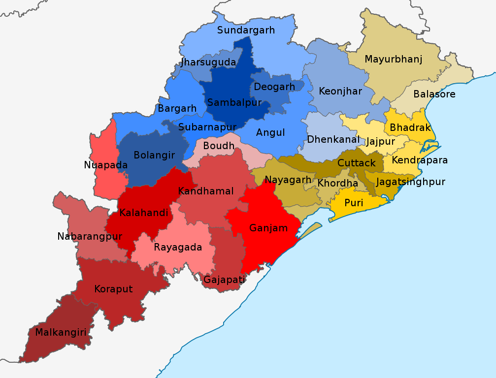
Odisha District Map
Largest and Smallest District in Odisha by Area
Mayurbhanj district covering an area of 10418 km² is the largest district in Odisha. Jagatsinghpur District is the smallest district in Odisha of with a total area of 1759 km²
| # By Area | District | Area |
| Largest | Mayurbhanj | 10418 km² |
| Smallest | Jagatsinghpur | 1759 km2 |
Source: Census 2011
Largest and Smallest District in Odisha by Population
Ganjam District is the most populated district in Odisha. Its Population as per the census 2011 is 35.30 Lakhs. Debagarh (Deogarh) District with a population of 3.12 Lakhs is the least populated district in Odisha.
| # by Population | District | Population (Census 2011) |
| Most Populated | Ganjam | 3,529,031 |
| Least | Debagarh (Deogarh) | 312,520 |
Highest and Lowest Population Density
Khordha District (800 people per km) has the highest Population density in Odisha. Kandhamal District with a population density of 91 people per km is the lowest-density district in Odisha
| # by Density | District | Density (person/km) |
| Highest | Khordha | 800 |
| Least | Kandhamal | 91 |
Source: Census 2011
Odisha Districts by Literacy rate
| # | District | Literacy rate |
| 1 | Angul | 77.53% |
| 2 | Balangir | 64.72% |
| 3 | Balasore | 79.79% |
| 4 | Bargarh (Baragarh) | 74.62% |
| 5 | Bauda | 71.61% |
| 6 | Bhadrak | 82.78% |
| 7 | Cuttack | 85.50% |
| 8 | Debagarh (Deogarh) | 72.57% |
| 9 | Dhenkanal | 78.76% |
| 10 | Gajapati | 53.49% |
| 11 | Ganjam | 71.09% |
| 12 | Jagatsinghpur | 86.59% |
| 13 | Jajpur | 80.13% |
| 14 | Jharsuguda | 78.86% |
| 15 | Kalahandi | 59.22% |
| 16 | Kandhamal | 64.13% |
| 17 | Kendrapara | 85.15% |
| 18 | Kendujhar (Keonjhar) | 68.24% |
| 19 | Khordha | 86.88% |
| 20 | Koraput | 49.21% |
| 21 | Malkangiri | 48.54% |
| 22 | Mayurbhanj | 63.17% |
| 23 | Nabarangpur | 46.43% |
| 24 | Nayagarh | 80.42% |
| 25 | Nuapada | 57.35% |
| 26 | Puri | 84.67% |
| 27 | Rayagada | 49.76% |
| 28 | Sambalpur | 76.22% |
| 29 | Subarnapur (Sonepur) | 74.42% |
| 30 | Sundargarh | 73.34% |
Source: Census 2011
Odisha Districts by Sex Ratio
Rayagada district (1051) has the highest Male-Female Sex ratio in Odisha. Nayagarh District (915) has the lowest male-female sex ratio in Odisha.
| # | District | Sex Ratio |
| 1 | Angul | 943 |
| 2 | Balangir | 987 |
| 3 | Balasore | 957 |
| 4 | Bargarh (Baragarh) | 977 |
| 5 | Bauda | 991 |
| 6 | Bhadrak | 981 |
| 7 | Cuttack | 940 |
| 8 | Debagarh (Deogarh) | 975 |
| 9 | Dhenkanal | 947 |
| 10 | Gajapati | 1043 |
| 11 | Ganjam | 983 |
| 12 | Jagatsinghpur | 968 |
| 13 | Jajpur | 973 |
| 14 | Jharsuguda | 953 |
| 15 | Kalahandi | 1003 |
| 16 | Kandhamal | 1037 |
| 17 | Kendrapara | 1007 |
| 18 | Kendujhar (Keonjhar) | 988 |
| 19 | Khordha | 929 |
| 20 | Koraput | 1032 |
| 21 | Malkangiri | 1020 |
| 22 | Mayurbhanj | 1006 |
| 23 | Nabarangpur | 1019 |
| 24 | Nayagarh | 915 |
| 25 | Nuapada | 1021 |
| 26 | Puri | 963 |
| 27 | Rayagada | 1051 |
| 28 | Sambalpur | 976 |
| 29 | Subarnapur (Sonepur) | 960 |
| 30 | Sundargarh | 973 |
Source: Census 2011
Know more about Odisha