Noida City - Divisions | Map of Noida

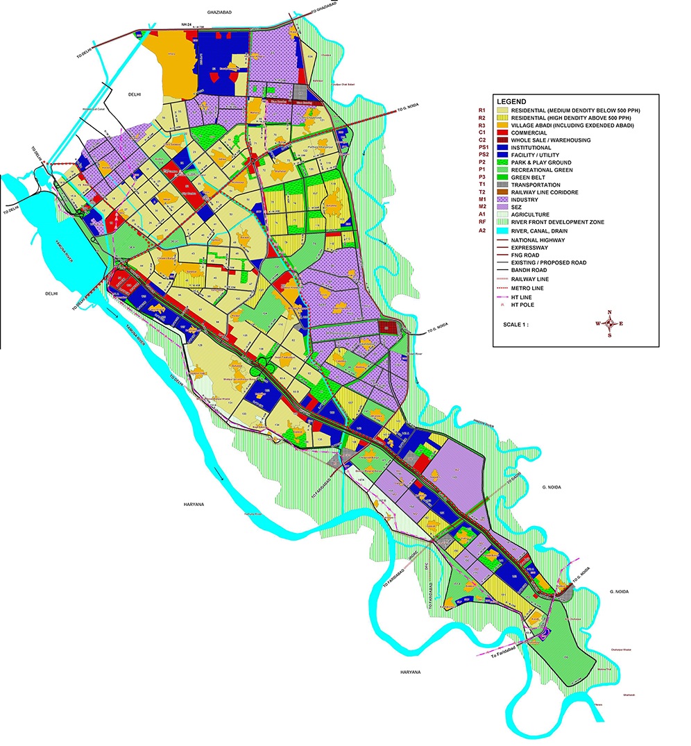
As per Map of Noida (master plan 2031), Noida has a total of 163 Sectors.  At present, the numbering of Sectors in Noida starts from Sector 1 to Sector 168. As of Now Sector 13, Sector 103, Sector 109, Sector 114, and Sector 111 do not exist. So we have a total of 163 sectors as per Master Plan Map. Now let’s understand the Noida Map in detail.

Map of Noida - Details & Categories

Map of  Noida is categorised  & marked as following

  1. Residential – Light Yellow
  2. Residential High Density – Yellow with strips
  3. Village Abadi – Dark Yellow
  4. Institutional – Blue
  5. Industry – Purple with Dots
  6. SEZ – Purple with Strips
  7. Commercial – Red
  8. Agriculture – Green Strips
  9. Wholesale/ Warehousing – Red with Checks
  10. Transportation – Grey with Checks
  11. Greens (Recreational, Park & playgrounds)

Map of Noida

Source: Noida Master Plan

Noida City – Divisions | Map of Noida​
Tagged on:         

Rajeev Rana

Rajeev Rana is an independent writer and researcher with a strong interest in history, population studies, and demographic trends in India and North America. He has been writing on demography-related topics for over five years, focusing on census data, migration patterns, ethnicity, and regional population changes. While not a formally certified demographer, Rajeev closely follows official data releases from government sources, census authorities, and reputable research institutions. His work aims to present complex demographic information in a clear, accessible, and neutral manner for readers seeking factual insights and broader context. Rajeev contributes to multiple informational websites and has particular familiarity with demographic and regional trends in the Delhi NCR region. His writing is driven by curiosity, data interpretation, and a commitment to accuracy rather than advocacy or opinion

One thought on “Noida City – Divisions | Map of Noida​

Leave a Reply