> > India >> States >> Districts in India
do you want to know How many districts in Maharashtra / Total district in Maharashtra ?
Nestled in the vibrant landscape of western India, Maharashtra stands as a powerhouse of culture, commerce, and diversity. As the second-most-populous state in India, Maharashtra holds a pivotal position in shaping the socio-economic and cultural dynamics of the nation. As of the latest available information in 2024, Maharashtra is administratively divided into 36 districts, each contributing to the state’s multifaceted identity and overall development.
Ahmednagar district is the largest district by area and Mumbai City District is the smallest district of Maharashtra. Pune District is the most populated district and Sindhudurg District is the least populated district in Maharashtra.
read about the population of Maharashtra
List of Districts in Maharashtra
| # | District | Population (2011) | Area (km2) |
| 1 | Ahmednagar | 4,543,083 | 17,048 |
| 2 | Akola | 1,818,617 | 5,429 |
| 3 | Amravati | 2,887,826 | 12,235 |
| 4 | Aurangabad | 3,695,928 | 10,107 |
| 5 | Beed | 2,585,962 | 10,693 |
| 6 | Bhandara | 1,198,810 | 3,890 |
| 7 | Buldhana | 2,588,039 | 9,661 |
| 8 | Chandrapur | 2,194,262 | 11,443 |
| 9 | Dhule | 2,048,781 | 8,095 |
| 10 | Gadchiroli | 1,071,795 | 14,412 |
| 11 | Gondia | 1,322,331 | 5,431 |
| 12 | Hingoli | 1,178,973 | 4,526 |
| 13 | Jalgaon | 4,224,442 | 11,765 |
| 14 | Jalna | 1,958,483 | 7,718 |
| 15 | Kolhapur | 3,874,015 | 7,685 |
| 16 | Latur | 2,455,543 | 7,157 |
| 17 | Mumbai City | 3,145,966 | 69 |
| 18 | Mumbai suburban | 9,332,481 | 369 |
| 19 | Nanded | 3,356,566 | 10,528 |
| 20 | Nandurbar | 1,646,177 | 5,055 |
| 21 | Nagpur | 4,653,171 | 9,892 |
| 22 | Nashik | 6,109,052 | 15,539 |
| 23 | Osmanabad | 1,660,311 | 7,569 |
| 24 | Palghar | 2,990,116 | 5,344 |
| 25 | Parbhani | 1,835,982 | 6,511 |
| 26 | Pune | 9,426,959 | 15,643 |
| 27 | Raigad | 2,635,394 | 7,152 |
| 28 | Ratnagiri | 1,612,672 | 8,208 |
| 29 | Sangli | 2,820,575 | 8,572 |
| 30 | Satara | 3,003,922 | 10,475 |
| 31 | Sindhudurg | 848,868 | 5,207 |
| 32 | Solapur | 4,315,527 | 14,895 |
| 33 | Thane | 11,060,148 | 4,214 |
| 34 | Wardha | 1,296,157 | 6,309 |
| 35 | Washim | 1,196,714 | 5,155 |
| 36 | Yavatmal | 2,775,457 | 13,582 |
read about religion in Maharashtra
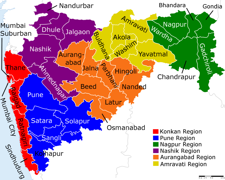
Maharashtra District Map
Largest and Smallest District in Maharashtra by Area
Ahmednagar district covering an area of 17048 km² is the largest district of Maharashtra. Mumbai City District is the smallest district of Maharashtra total area is 36 km²
| # By Area | District | Area |
| Largest | Ahmednagar | 17048 km² |
| Smallest | Mumbai City District | 36 km2 |
Source: Census 2011
Largest and Smallest District in Maharashtra by Population
Pune District is the most populated district in Maharashtra. Its Population as per census 2011 is 94.30 Lakhs. Sindhudurg District with a population of 8.50 Lakhs is the least populated district in Maharashtra
| # by Population | District | Population (Census 2011) |
| Most Populated | Pune | 9426959 |
| Least | Sindhudurg | 848868 |
Highest and Lowest Population Density
Mumbai City District (45,594 people per km) has the highest Population density in Maharashtra. Gadchiroli District with a population density of 74 people per km is the lowest-density district in Maharashtra.
| # by Density | District | Density (person/km) |
| Highest | Mumbai City District | 45594 |
| Least | Gadchiroli | 74 |
Source: Census 2011
Maharashtra District with Highest and Lowest Literacy rate
| # by Literacy Rate | District | Literacy Rate |
| Most Literate | Mumbai Suburban | 89.91% |
| Least | Nandurbar | 64.38% |
Source: Census 2011
Maharashtra District with Highest and Lowest Male Female Ratio
Ratnagiri district (1122) has the highest Male-Female Sex ratio in Maharashtra. Mumbai City District (832) has the lowest male-female sex ratio in Maharashtra
| # by Literacy Rate | District | Sex ratio |
| Highest | Ratnagiri | 1122 females to 1000 males |
| Lowest | Mumbai City District | 832 females to 1000 males |
Source: Census 2011
Know more about Maharashtra